


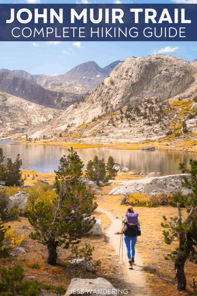
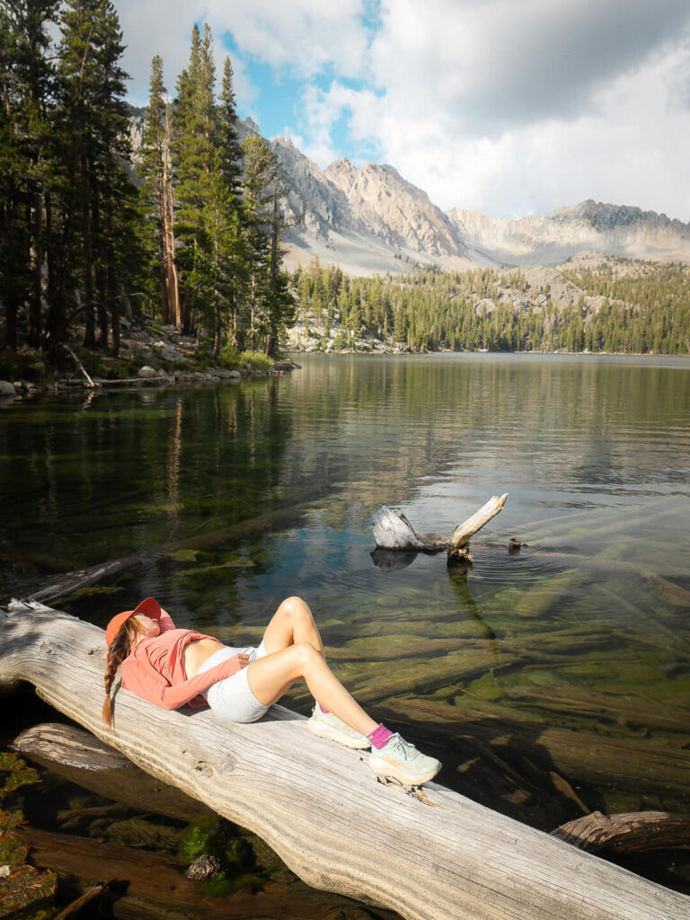
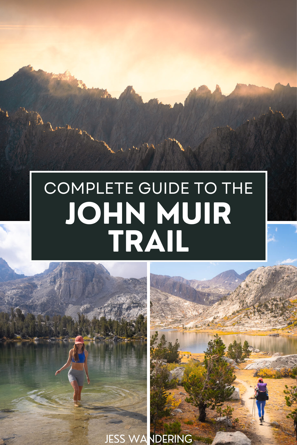
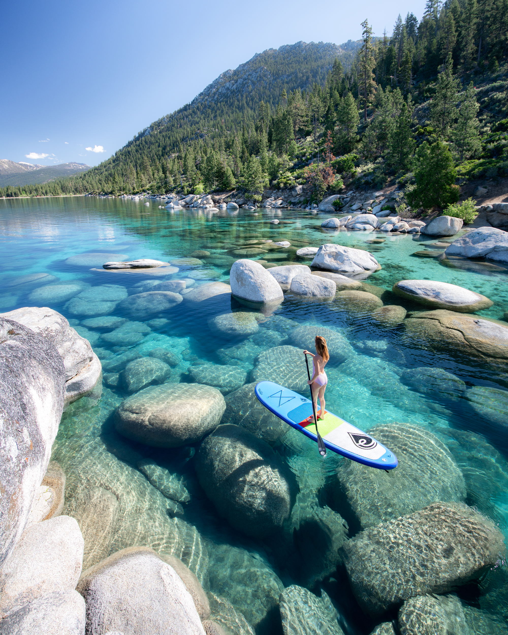
There are places that live in your imagination long before you ever set foot in them. For me, the John Muir Trail was one of those places.
I had seen the photos, the glassy lakes, the granite peaks, and the endless switchbacks climbing toward the sky. But what drew me most was the promise of something slower. A stretch of time without service or noise or schedules. Just movement, one step at a time, through some of the most beautiful wilderness in the Sierra Nevada.
By the time I finally started the trail, I was craving that kind of quiet. I wanted space to think, or maybe not think at all. I wanted to see what would happen when there was nothing left to distract me from the simple rhythm of walking, eating, sleeping, and waking up to do it again.
The JMT ended up being so much more than a hike. It was a lesson in patience, in letting go of control, and in finding joy in the smallest moments. It reminded me that nature has a way of showing you what you need most, even when it is not what you planned.
Before diving into the day-by-day journal, here is a quick look at the trail itself and what makes it such a special journey.
The John Muir Trail At A Glance
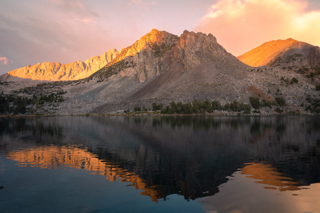
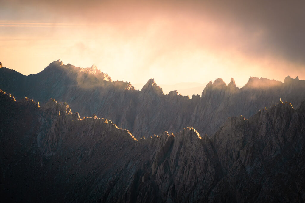
The John Muir Trail stretches through the heart of California’s Sierra Nevada, connecting three of the state’s most iconic national parks. It begins in Yosemite Valley and climbs through high alpine basins, meadows, and granite passes before ending at the summit of Mount Whitney, the highest point in the contiguous United States.
It is a trail of extremes: long climbs, quiet valleys, and weather that can shift from sunshine to hail in minutes. But for those willing to take it one step at a time, it offers an experience that is equal parts challenge and wonder.
| Distance | 211 miles (340 km) / 221 miles to Whitney Portal |
| Route | Yosemite Valley to Mount Whitney |
| National Parks | Yosemite, Kings Canyon, Sequoia |
| Highest Point | Mount Whitney – 14,505 ft (4,421 m) |
| Major Passes | Donohue, Muir, Mather, Pinchot, Glen, Forester |
| Average Duration | 2 to 3 weeks |
| Elevation Gain | Approximately 47,000 feet total |
| Permit Required | Yes, typically issued by Recreation.gov |
| Best Season | July through Mid-September |
| Fun Fact | The JMT overlaps with the Pacific Crest Trail for almost its entire length. |
My John Muir Trail Experience
The John Muir Trail is the kind of trip that’s hard to explain until you’re out there living it. Some days feel endless, others are over before you even realize what happened. You spend hours walking in silence, then suddenly everything around you feels too beautiful to put into words.
This section is my personal journal from the trail. It’s not a guide or a checklist of highlights. It’s the reality of what it felt like to walk from Yosemite to Whitney — the good, the hard, and everything in between.
If you’re planning your own hike, I hope these entries give you a better sense of what it’s really like out there. And if you’re just here to follow along, welcome to the trail.

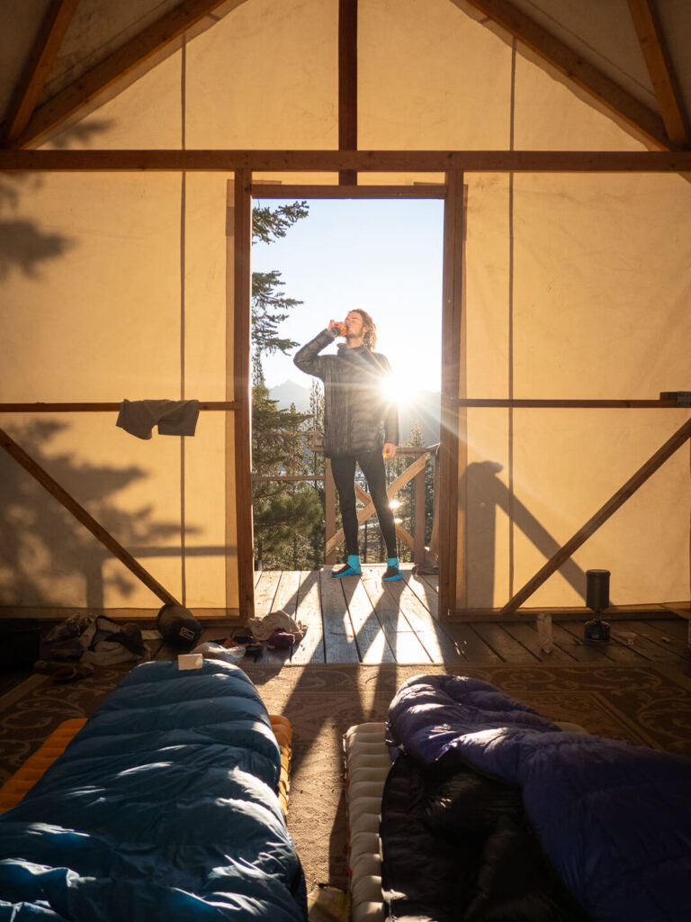
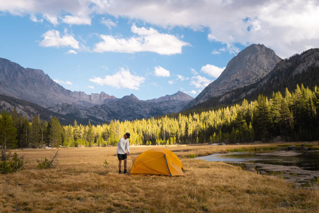
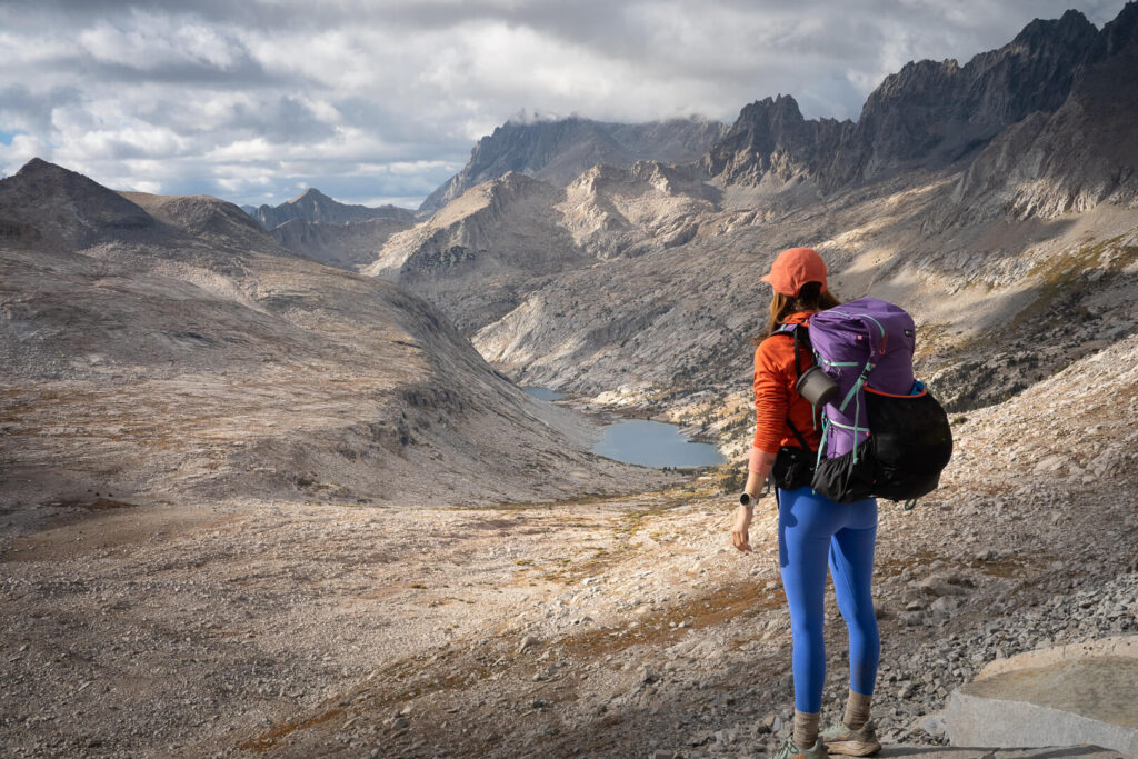
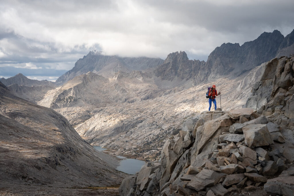
Day 1: Yosemite Valley to The Wild Unknown (10 miles / JMT mile 10)
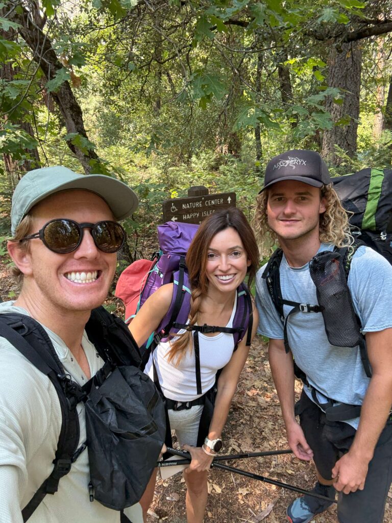
The John Muir Trail begins like a baptism — straight up the Mist Trail, climbing beside Vernal and Nevada Falls as mist coats every exposed inch of skin. My pack weighed close to thirty pounds, and by the first switchback I was already questioning every ounce.
We’d picked up our permits at the Yosemite Wilderness Center that morning, hit the trail just after noon, and quickly learned that starting a long-distance hike with a climb like this is no joke. Between detours from trail construction and photo stops at the top of Nevada Falls, progress was slow.
Our original plan was to push all the way to Cathedral Lakes, but as the light faded, reality set in. We had gone ten miles, our legs were shot, and we were still deep in the forest. Around 7 p.m., we stumbled on a flat patch of ground beside a creek — an unplanned but perfect camp.
A bear wandered by earlier that afternoon, the first of many we’d see. Quin and Isaac got way too close (typical), but watching it forage among the trees was a wild reminder that we were guests here.
Looking back, I’m glad we skipped adding Half Dome to our permit. I’ve climbed it before, and while the cables are a bucket-list experience, starting the JMT with that extra detour would’ve been brutal. Still, if you’ve never done it, this is one of the best ways to tag it without the crowds.
Day 2: Yosemite to Lyell Canyon (18 miles)
We woke around 7 a.m., slow and sore, and hit the trail by 8:30. The day started with a steady climb over a pass before opening into a series of rolling meadows that felt like something out of an old western. Around midday we sprawled out in the sun near one of the High Sierra Camps, surrounded by golden grass and the sound of wind brushing through pines.
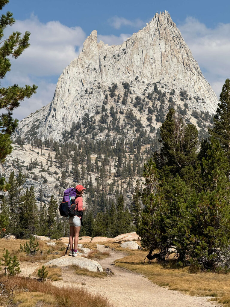
If there’s a theme emerging early on the JMT, it’s that you can’t linger everywhere you want to. Cathedral Lakes looked impossibly inviting, but we were behind schedule, so we kept walking. If i could re-do our itinerary fir the first couple nights I’d definitely try to camp here. It has some of my favorite backcountry camping sites in Yosemite.
By mid-afternoon, we rolled into Tuolumne Meadows, one of the few places along the JMT where you can grab real food without veering too far off trail. A cheeseburger and yogurt from the small store never tasted so good. From there, we pushed another four miles before camping near Lyell Creek, just beyond the Yosemite border.
It was our first night outside the park — and somehow, it already felt like we’d entered a different world.
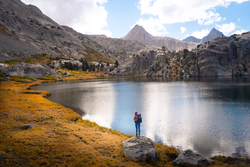
Day 3: Lyell Canyon to Thousand Island Lake (15 miles / JMT Mile 42)
We woke to gray skies and the smell of wet grass. The first five miles were flat and fast, tracing the Lyell Fork before the trail tilted upward toward Donohue Pass — the gateway out of Yosemite and into the Ansel Adams Wilderness.
The climb was slow but steady. Issac and I played the alphabet game to pass the time. Wind howled at the top, carrying the first hints of an approaching storm. We took a quick break to check the weather (thanks to one random pocket of cell service), then started the descent. Just as we reached Island Pass, the drizzle began.
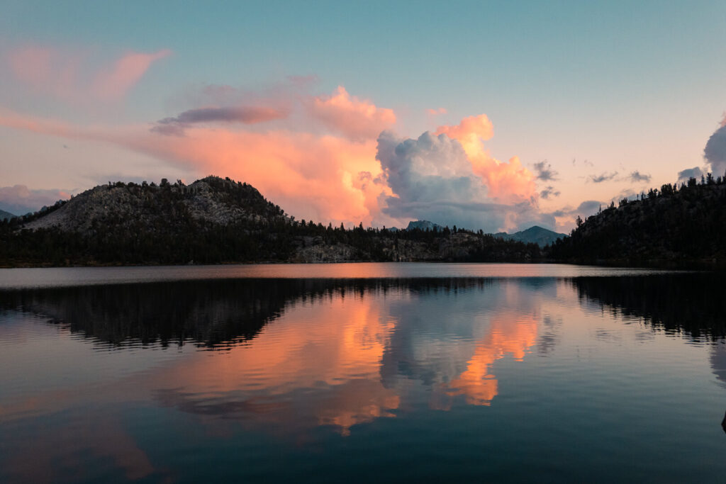
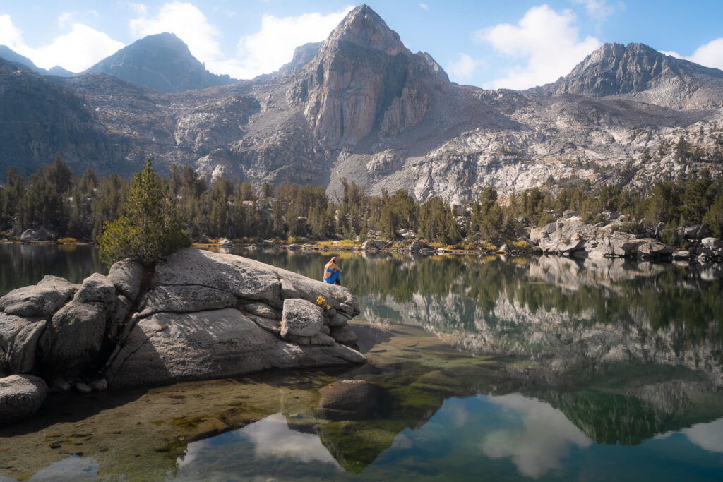
By the time we arrived at Thousand Island Lake, the rain had turned steady. I’d dreamed of this lake for years — its mirrored surface dotted with granite islands, Banner Peak towering behind it — but by the time we set up camp, everything was soaked. Within an hour, so were we.
It’s strange how often the moments you’ve romanticized most end up being the hardest. I’d waited so long to see this place, and all I could do was crawl into my tent, listen to the rain, and hope morning would bring better luck.
Day 4: Thousand Island Lake to Red’s Meadow (JMT Mile 42–58)
If I had to pick one day that tested my will to finish the JMT, this would be it.
It rained through the night and into the morning, soaking the tent and everything inside. By dawn, water was seeping through the walls, our packs were waterlogged, and every layer of clothing felt damp and cold. We debated waiting it out, but eventually packed up and started walking. It never stopped raining.
The trail from Thousand Island Lake to Red’s Meadow is usually one of the most scenic stretches of the John Muir Trail, with sweeping views of the Ritter Range and deep pine forests. But that day, I saw almost none of it. My rain hood narrowed my world to the few feet of muddy trail in front of me.
The sopping wet tent, now rolled up under the lid of my pack, felt three times heavier than usual. Every break was short, every mile felt endless. By the time we reached Red’s Meadow, we were soaked, exhausted, and thoroughly over it.
As if things couldn’t get worse, our lighter stopped working. Red’s Meadow had already closed for the season, which meant no store, no restaurant, no help. I tried calling an Uber to get into Mammoth, but no luck. Quin and Isaac eventually found an unlocked cabin and decided to sleep inside for the night. I stayed in my tent, trying to ignore the pitter patter of rain outside that still hadn’t let up.
The only sliver of good news was that it was Friday, which meant that the Reds Meadow shuttle which had stopped running during the week for the season, would be running the next day. We decided that in the morning, we’d take the shuttle into Mammoth, dry everything out, and reset.
Day 5: Zero Day in Mammoth Lakes (JMT Mile 58)
When the first shuttle finally came, an hour later than scheduled, it felt like salvation. Civilization had never sounded so good. We shared the ride with a handful of Pacific Crest Trail hikers who insisted that the conditions the last 42 hours had been the worst they had experienced in months on the trail. A couple had even resorted to sleeping on the floor of trailhead restroom. The confession made me feel slightly better about bailing on the trail for the day.
We booked a small Airbnb in town, and our first mission was food. We headed straight to The Stove for brunch, where I ordered a chorizo scramble that tasted like the best thing I’d ever eaten. The sun was out, the sky was clear, and the irony wasn’t lost on us that the moment we stepped off trail, the weather turned perfect.
Back at the condo, we unpacked every piece of gear and laid it in the sun to dry. Then we made the usual zero-day circuit of resupply stops: Grocery Outlet, Vons, and a couple of outdoor shops. I bought a pair of waterproof gloves, a backup lighters, and more snacks than I could have ever hopped to eat.
We wrapped the day with burritos at El Charro Taqueria. The California burrito there is life-changing. It was exactly the kind of comfort that only a hot meal and dry clothes can bring after days of rain.
Day 6: Red’s Meadow to Lake Virginia (JMT Mile 58–73)
We almost missed the last shuttle back to Red’s Meadow the next morning. Because it was late in the season, the bus only ran on weekends and only in the mornings. Between packing, grabbing one last latte from Looney Bean, and realizing that Mammoth has no Uber service, we cut it close. Thankfully, a kind driver gave us a ride just in time.
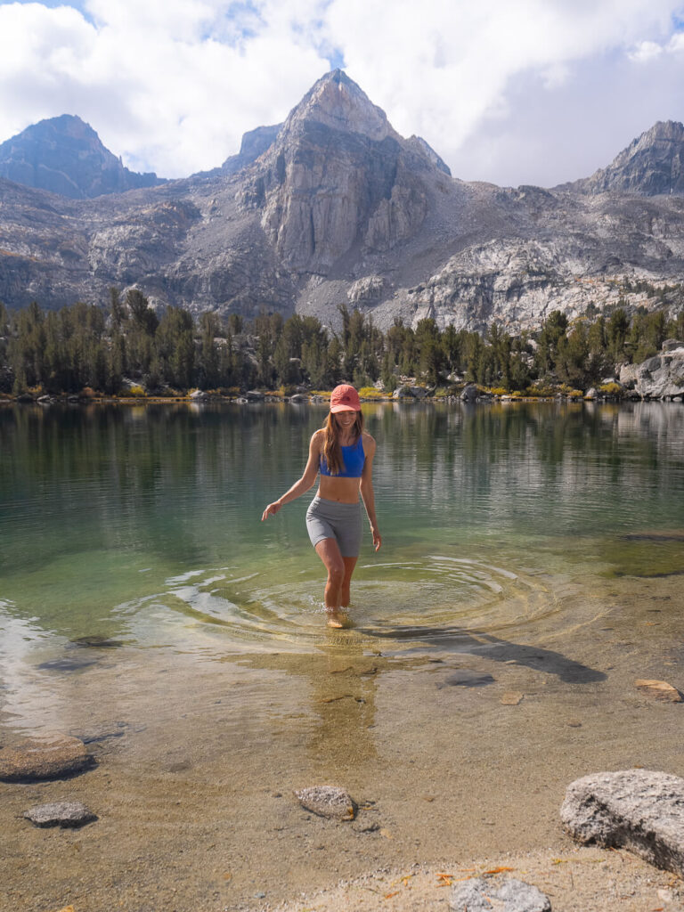
Once back on trail, everything clicked. The sun was shinning, my body felt strong again, and the miles seemed to fly by. The landscape opened up into long, dry stretches with little water, then climbed steadily toward Purple Lake. We stopped for a quick swim, and of course, the sun disappeared the second I got out. Luckily, a big uphill soon warmed me right back up.
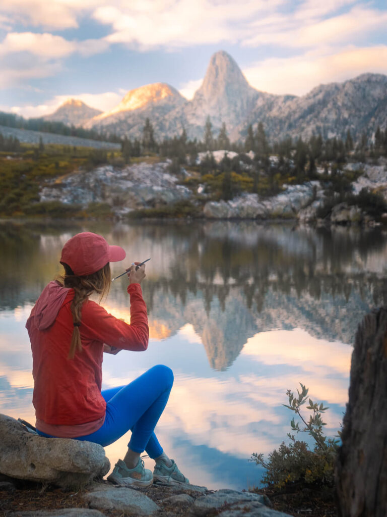
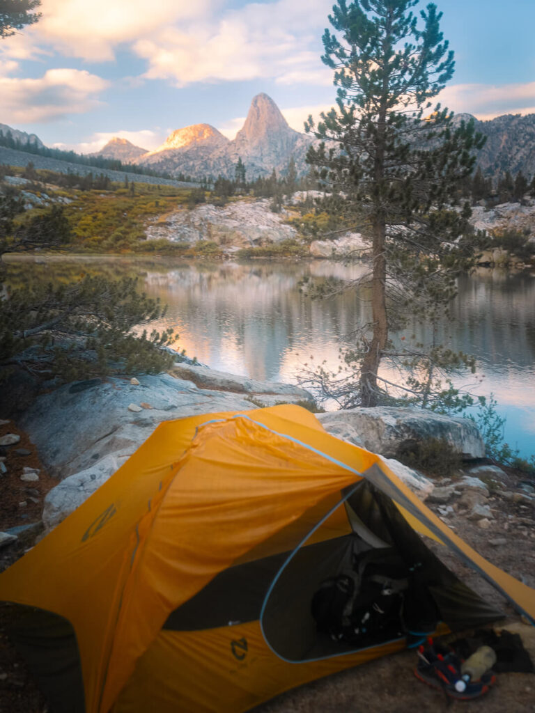
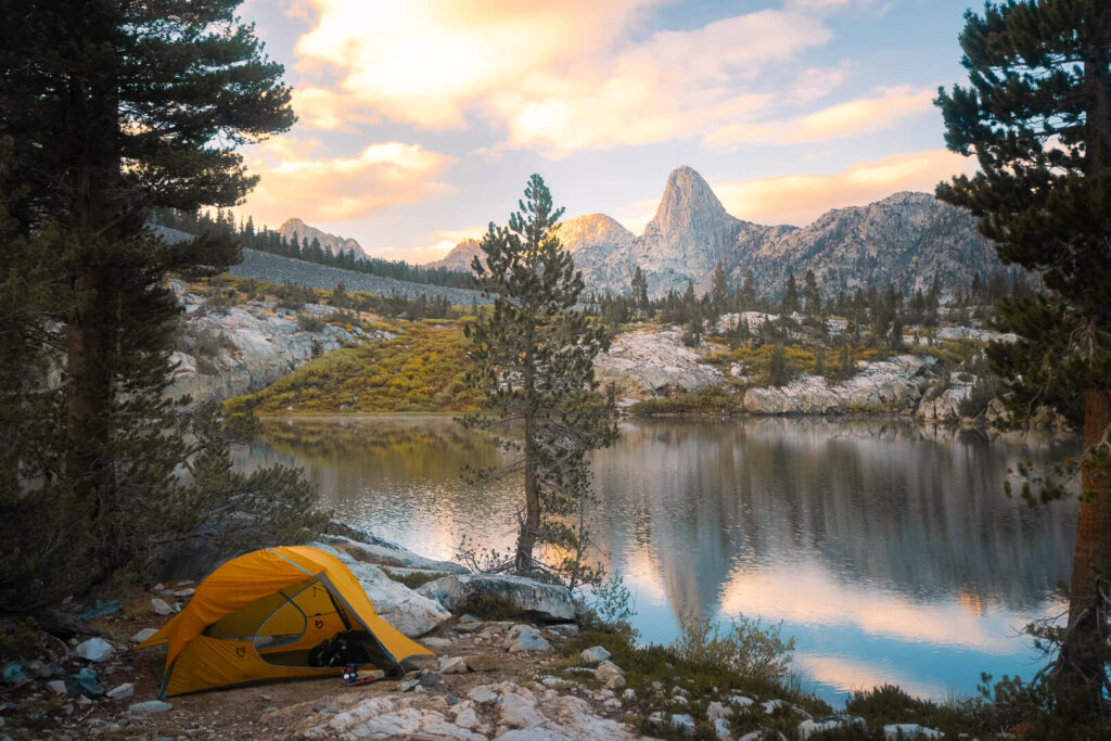
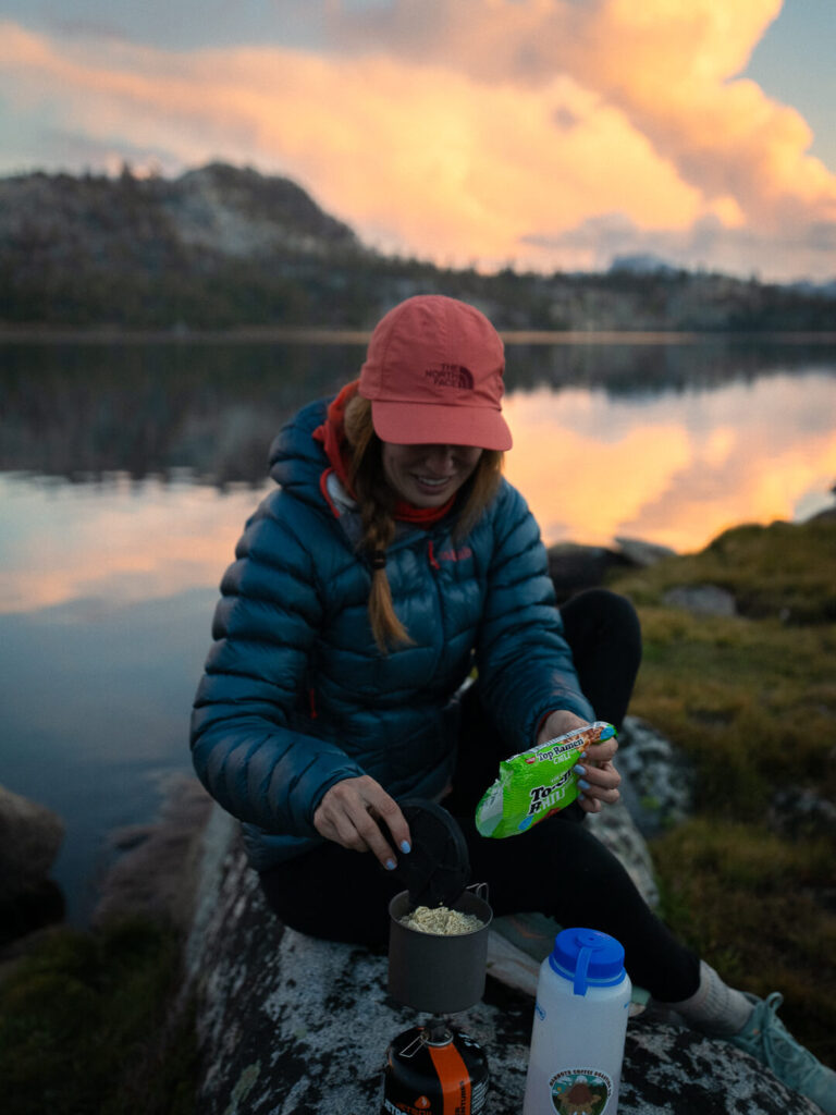
Just as we reached Lake Virginia, thunder rolled across the basin. Within minutes, rain poured down again. It lasted for about an hour, but when the clouds finally broke, we were rewarded with the most beautiful sunset of the trip.
After our last bout with the rain, watching the light spill over the water felt like a reset button for the soul. we ran around with our cameras, yelling, and cheering, taking photos like we’d never seen a sunset before. Now this is what I’d signed up for.
Day 7: Lake Virginia to Vermilion Valley Resort via Goodale Pass (JMT Mile 73–82)
We woke to our first freezing morning. A thin layer of frost covered the tents, but the sky was clear and blue, and the sun felt like a gift after so many gray days. We lingered in camp longer than usual, waiting for the dew to dry before packing up.
Today was a detour day. Our one and only resupply was waiting at Vermilion Valley Resort (VVR), which meant leaving the John Muir Trail for a side trip over Goodale Pass. Normally, hikers can take a ferry across Lake Edison to reach the resort, but the ferry had stopped running early for the season after the man who operated it for years passed away. So we hiked it. And then the resort itself had closed early due to a relatively close wildfire. But they were holding resupply packages for hikers until the end of the month.
The climb over Goodale Pass was long and steep, but stunning. We passed Papoose Lake, which shimmered in the sunlight like a mirror, and then descended for what felt like forever. In total, we hiked more than eighteen miles that day, gaining and losing thousands of feet of elevation.
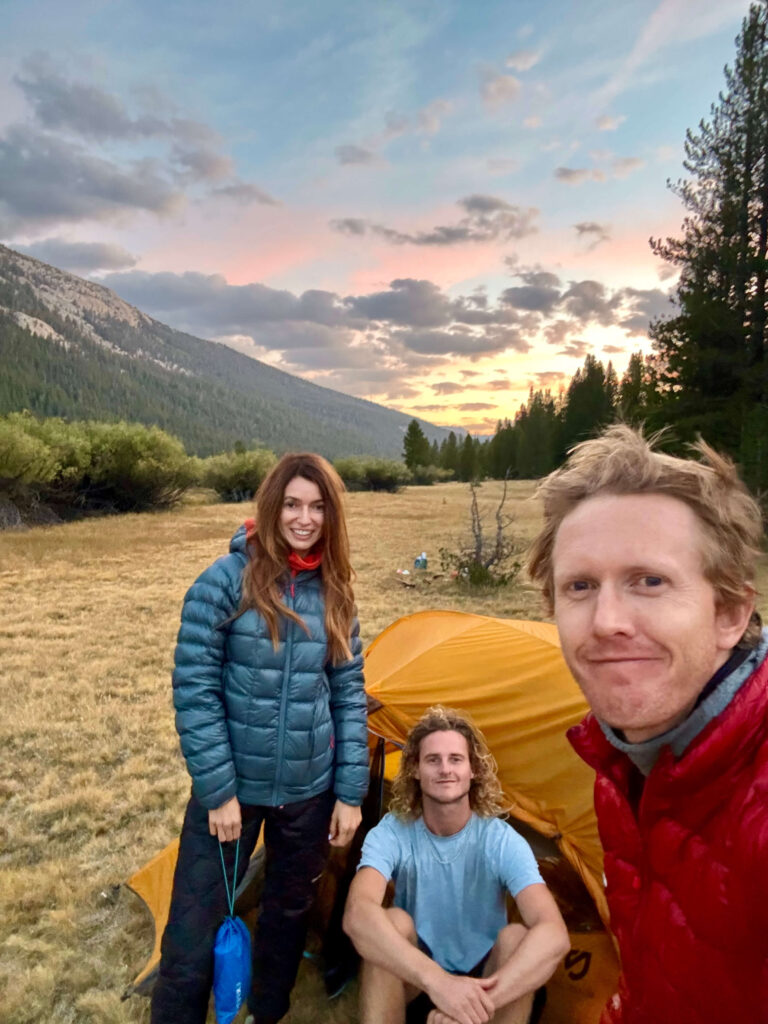
We walked through what felt like miles of empty campsites as we approched VVR. There was something almost apocalyptic about the empty campgrounds. Locked bathrooms, turned over bear boxes, and not a person in sight. It was hard to believe that only a couple weeks earlier this place was probably bustling with happy families taking advantage of the idealic lake setting. But when we finally arrived at the resort itself, we were greeted by a small crew of JMT and PCT hikers warming themselves by a fire. Raven, the caretaker, helped us retrieve our resupply boxes – $40 a pop.
That night we devoured Snickers bars, swapped trail stories with strangers, and crashed in one of the empty canvas tents. Civilization never felt so close, yet far at the same time.
Day 8: VVR to Marie Lake (JMT Mile 82–98.4)
We left VVR around 9 a.m. under bright blue skies, following the Bear Ridge Trail for seven miles before reconnecting with the JMT. About five miles in, I slipped on a log crossing the trail and fell hard on my left wrist. The impact was brutal. I immediately knew something was wrong.
Suddenly, everything was harder. Opening my bear can, setting up the tent, even pulling up my shorts was painful. It forced me to slow down and rely on Quin and Isaac more than I wanted to. To make things worse, one of the load lifters on my backpack tore loose later that day. For anyone unfamiliar, load lifters are small straps near the top of your pack that shift weight off your shoulders and stabilize the load. Losing one was a big deal, especially with more than a hundred miles left to go.
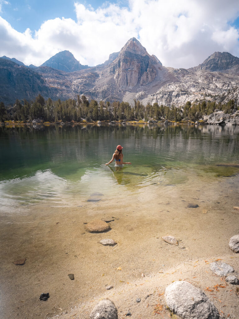
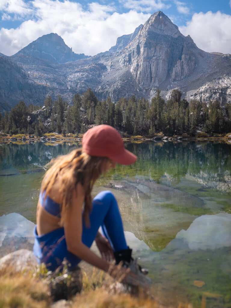
Isaac hiked ahead most of the day. The trail followed a beautiful river for miles, and Quin and I couldn’t resist stopping for a quick swim. The icy water was shocking at first but instantly refreshing, and for a few blissful minutes it numbed the throbbing in my wrist. When I finally climbed out, shivering, I found a big sun-warmed boulder tucked around a quiet bend in the river. I stretched out on the rock and let the heat sink in, feeling the goosebumps fade away. It was such a small, unremarkable moment on the trail — not showy like a fiery sunset or the thrill of summiting a pass — but even then, I knew it would be one of my favorites.
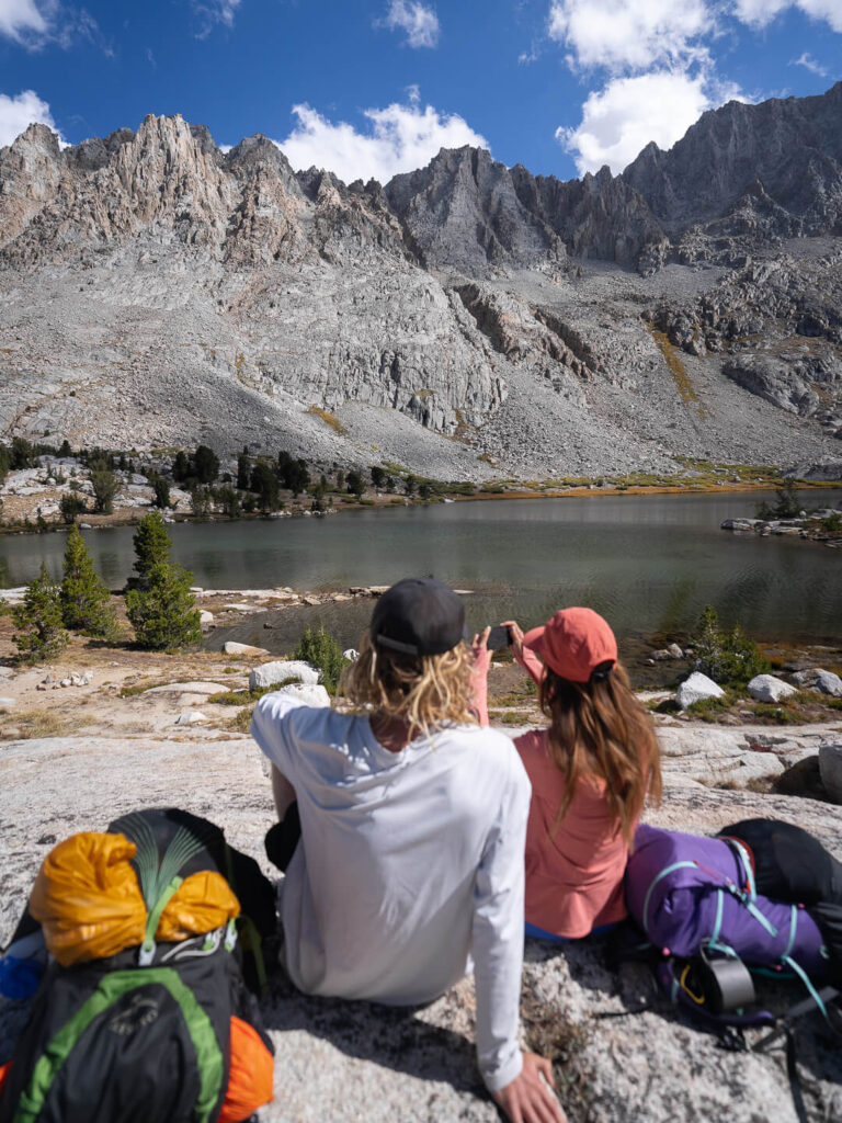
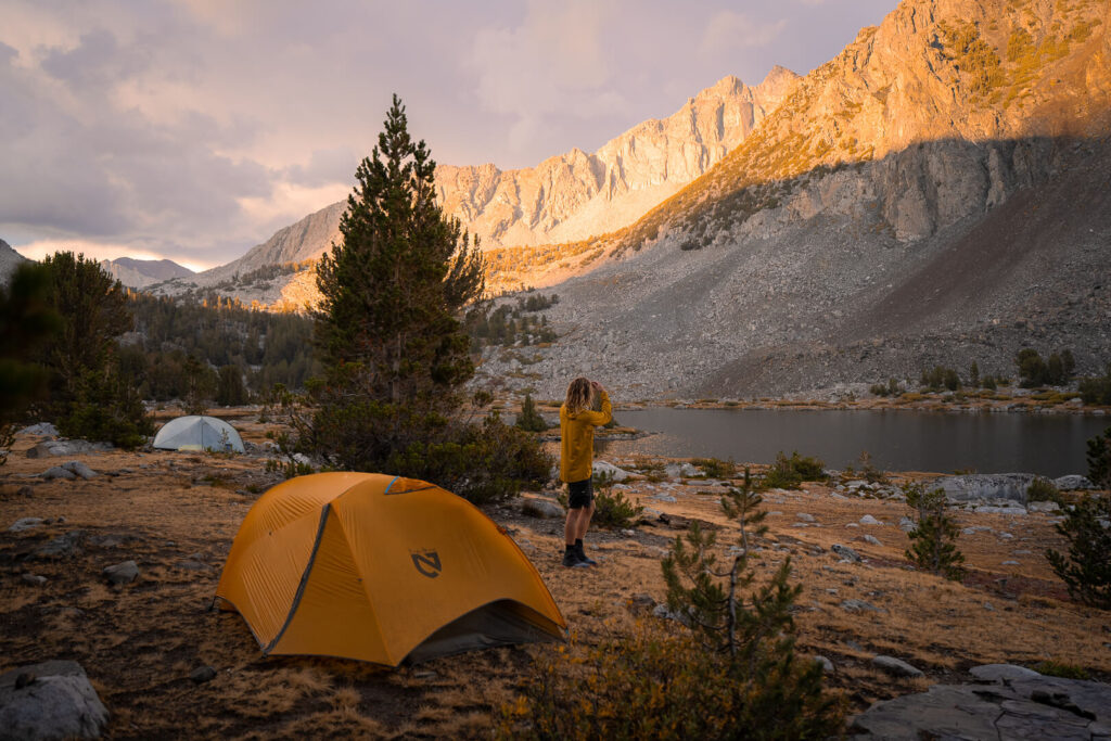
By evening we reached Marie Lake, one of the most beautiful camps of the trip. The water sparkled in the fading sun, and we took our time setting up camp and cooking dinner. After what could only be described as a “rough start” to the JMT, it finally felt like we were in rhythm with the trail. Minus my potentially broken arm. . . and definitely broken backpack.
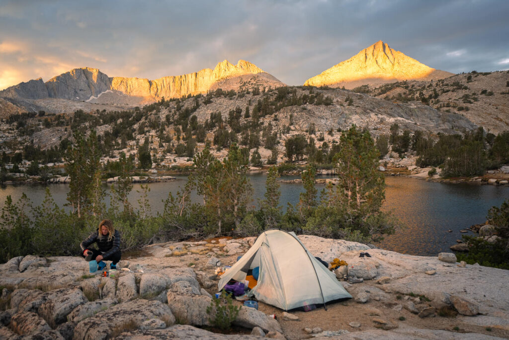
Day 9: Marie Lake to McClure Meadow (JMT Mile 98.4–116.7)
We woke to a soft pink sunrise reflecting on Marie Lake, and for the first time in days, everything was dry. It had been a warm night, spirits were high, and even though my wrist still hurt, I felt strong.
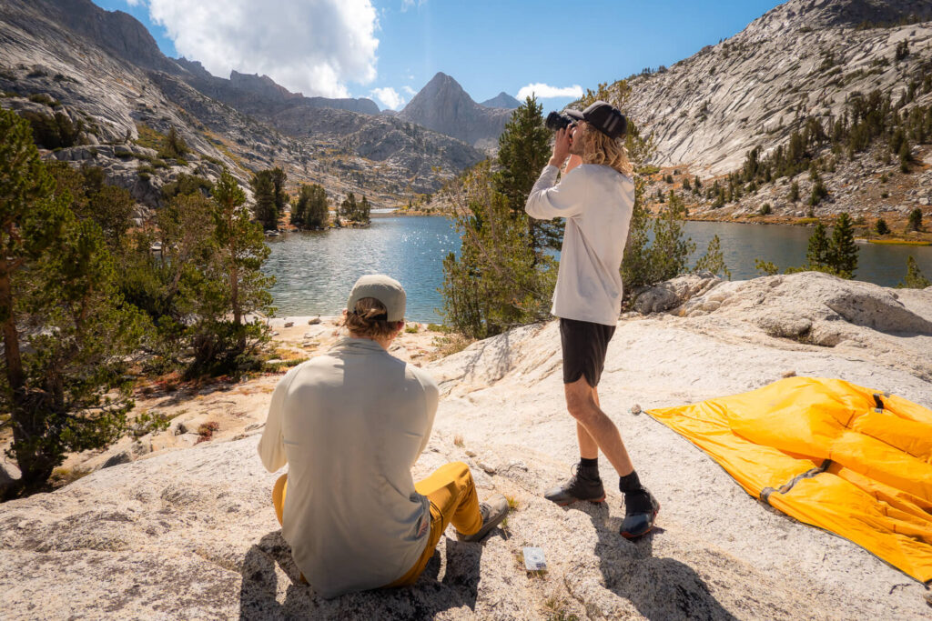
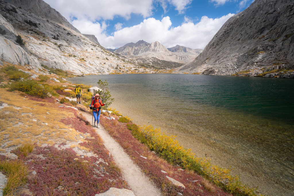
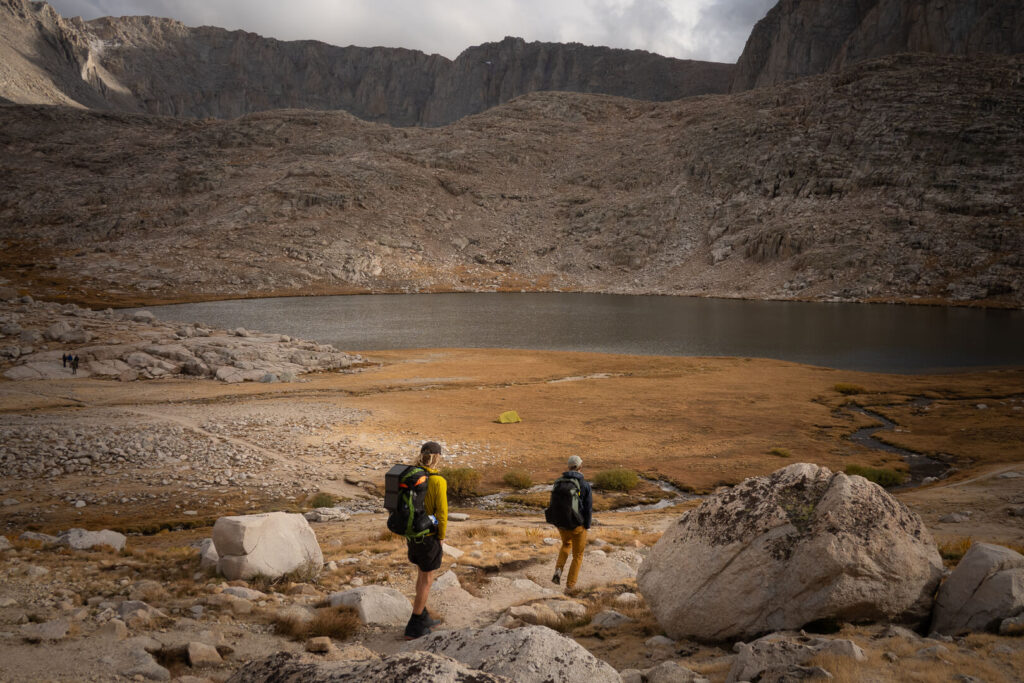
The morning climb above the lake offered incredible views back over the basin. Every turn seemed to reveal another alpine lake framed by jagged peaks. By midday, we crossed into Kings Canyon National Park, a huge milestone on the JMT.
The trail descended alongside a winding river, and Quin and I stopped again for a swim. There was something grounding about those short, simple moments between the climbs and miles. By the time we caught up with Isaac, we had reached McClure Meadow, one of the most picturesque camps on the entire trail.
Golden grass stretched across the valley floor with a sparkling creek running through the middle. As the last light of day faded, a family of deer crossed the meadow near our tents. It felt like a scene from another time, untouched and perfect.
Day 10: McClure Meadow to Middle Fork Kings River (JMT Mile 116.7–134.4)
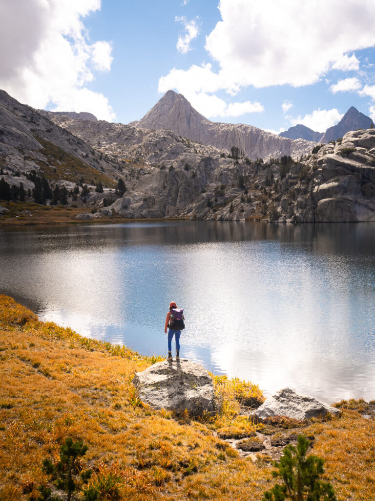
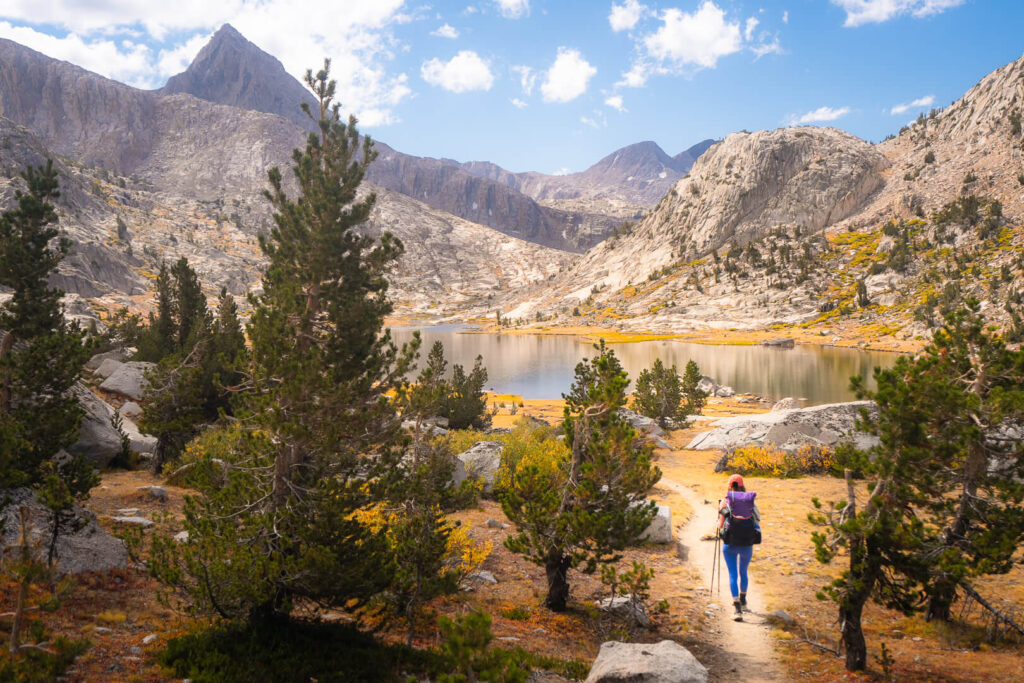
We set out early under a cloudless sky, determined to make it up and over Muir Pass before the next storm rolled in. The climb from Evolution Valley is one of the most iconic sections of the John Muir Trail, winding past a chain of lakes so beautiful they almost don’t seem real.
Evolution Lake was the highlight. Granite peaks rose sharply from turquoise water, and the first hints of fall color painted the meadows gold and red. I could have stayed there for days, but clouds were already forming on the horizon, and we still had a long climb ahead.
We reached the stone Muir Hut at the top of the pass just as the first drops of rain began to fall. Built by the Sierra Club in 1930, the small stone shelter honors John Muir himself. Inside, we flipped through the logbook filled with messages from hikers around the world. Most started with “Dear Daddy Muir,” followed by a short thank-you for inspiring generations of dreamers to walk these same mountains.
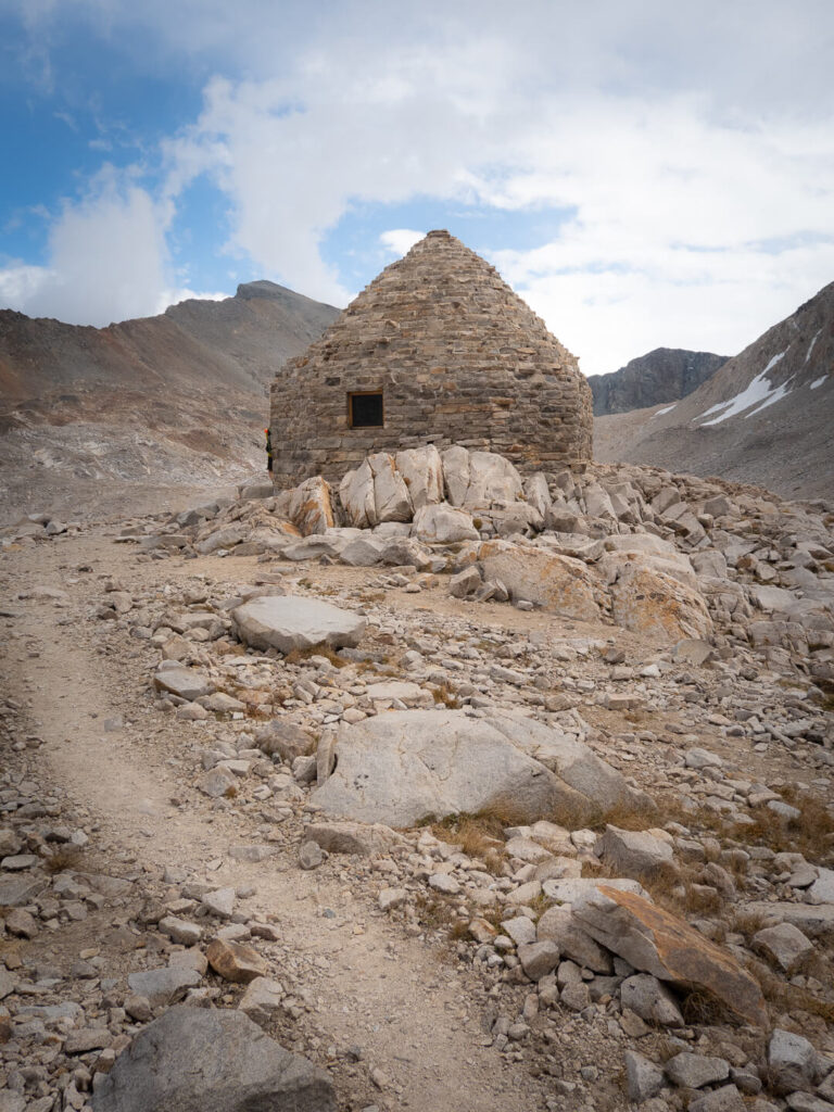
Outside, the wind howled and the sky turned black. We layered up, pulled our ponchos tight, and began the long descent. We passed right by some beautiful lakes including one named after John Muir’s daughter, Helen. I found myself wondering for the hundredth time what it would be like to hike though these mountains earlier in the season with endless sun and time. The storm followed us down the switchbacks, but by the time we reached camp near the Middle Fork of the Kings River, the rain had softened to a drizzle.
That night, as thunder echoed through the canyon, I couldn’t help but think that Muir himself would have loved this wild, unpredictable stretch of trail.
Day 11: Middle Fork Kings River to Kings River Camp (JMT Mile 134.4–153)
If I thought Muir Pass was challenging, Mather Pass quickly reminded me that the Sierra always has more to give.
The day began with a steep climb through the Golden Staircase, a legendary section of switchbacks carved into solid granite. Every turn seemed impossibly high above the last, but the views over Palisade Lakes made the struggle worth it. This was, without question, one of the most beautiful sections of the entire JMT.
By late afternoon, the sky predictably darkened again. Rain started falling just as we began searching for a campsite. Within minutes, it was pouring. When we finally set up the tent a couple miles further down the trail, we were drenched. Inside, our sleeping pads were floating on a few inches of water. No one wanted to leave the tent to cook, so Isaac volunteered to fetch water in the storm while Quin and I fired up the stove inside the vestibule. It was risky, but we managed not to burn the tent down.
We drifted off to sleep that night on our makeshift waterbed, every movement sending ripples across the floor. It would have been miserable if it wasn’t also, somehow, a little funny.
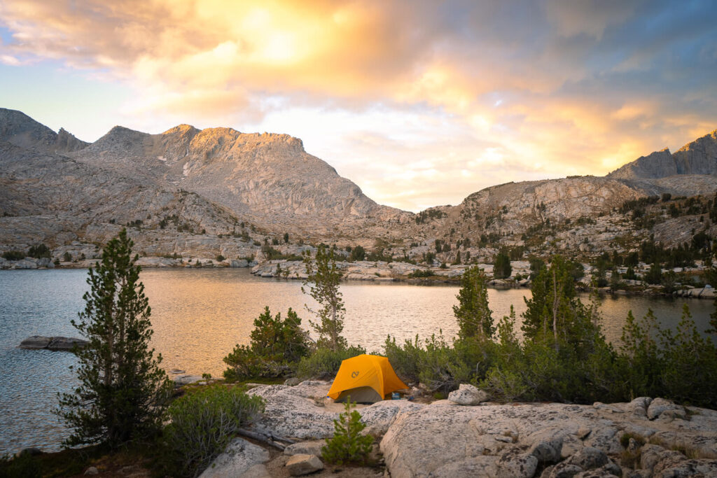
Day 12: Kings River Camp to Dollar Lake (JMT Mile 153–169)
None of us slept much. The rain from the night before soaked everything, and we were all still haunted by the rain that had nearly ended our trip the first week. Spirits were low. Our devices were nearly dead from lack of sunlight for the solar panel, and it felt like the weather had stolen our momentum.
The climb up Pinchot Pass was tough and cold, and by the time we reached the top, hail was bouncing off our jackets. That morning we had set a goal of making it to Rae Lakes, a place that has lived on my backpacking bucket list for nearly a decade.
Our plan was to camp there, but by six o’clock we were still three miles away and completely spent. Then we came upon Dollar Lake. The water was still and glassy, reflecting the surrounding peaks like a mirror, and moody skies had temporarily opened up. It was too beautiful to pass up.
We set up camp and cooked dinner as the sun disappeared behind the ridge. That night, the three of us squeezed into our two-person tent, huddled together to watch Miss Congeniality on Quin’s phone. For the first time in days, everything was dry. I think it was the best night of sleep I had on the trail.
Day 13: Dollar Lake to Camp Below Forester Pass (JMT Mile 169–183.4)
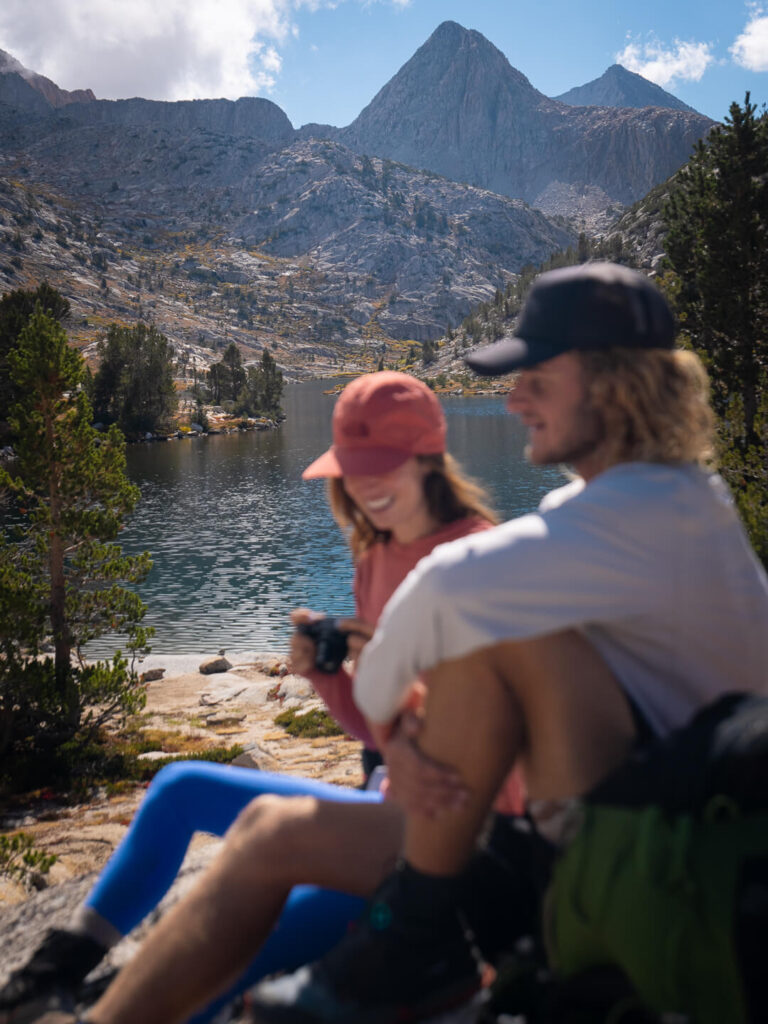
We woke a little earlier than usual, determined to make up for the shorter day before. The September daylight hours were getting shorter, which made it harder to stop and linger the way I wanted to. Since Rae Lakes had been on my backpacking bucket list for so long, I wanted to make sure we had time to stop and enjoy it.
By 7:30 a.m., we were packed up and on the trail. Within an hour, we reached the first views of Middle Rae Lake, but the sky was gray and clouded. We decided to keep going, hoping the weather might shift. Half an hour later, it did. The clouds broke, revealing blue skies and sunlight spilling over the lake.
We set up the tent to dry out while we took photos and explored, killing two birds with one stone. For about an hour and a half, we just existed there — soaking our feet, letting the warmth return to our bodies, and trying to memorize these fleeting moments of bliss. It felt good to slow down, even if only for a short while.
Isaac left early to scout for a sunny spot to charge the solar panel. When we caught up later, he was stretched out on some boulders with the panel propped beside him, sunbathing like he’d been there for hours. He had also seen a family of bears, which I was sad to have missed, but I would not have traded that time at the lake for anything.
We headed up Glenn Pass together and then cruised through the rest of the day. We made camp just below Forester Pass, at nearly twelve thousand feet. The air felt thin, and the night came cold and fast.
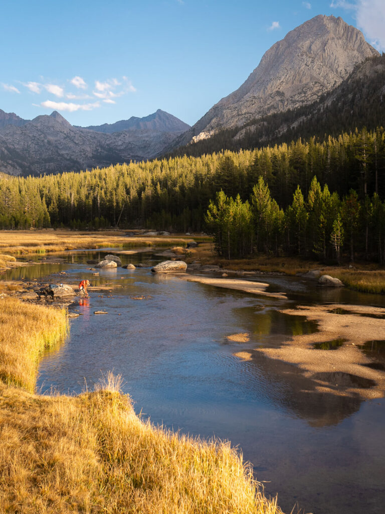
Day 14: Camp Below Forester Pass to Camp Near Guitar Lake (JMT Mile 183.4–202.3)
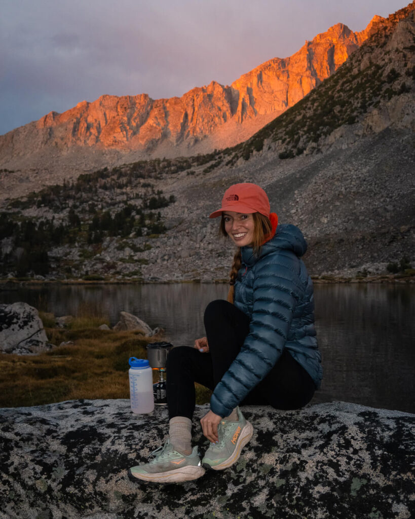
We woke to a thick layer of frost coating the tent, evidence that we were deep into the high country now. Isaac set out early, hoping to catch sunrise from the top of Forester Pass, while Quin and I let ourselves sleep an extra hour, saving energy for the long day ahead.
By the time we started climbing, the first light was hitting the switchbacks. As the sun rose, it illuminated each consecutive switchback for us as if it was guiding the way. Even though Forester is the highest pass on the John Muir Trail at just over 13,000 feet, it did not feel harder than the ones before. Maybe we had finally found our trail legs, or maybe it was the weather. The morning was clear and calm, the light shifting from pink to gold as we climbed. It was one of my favorite mornings of the entire trip.
At the top, a small sign marked the boundary between Kings Canyon and Sequoia National Park. The start difference in conditions from one side of the pass to the other was surreal.Turning one way, the view over Kings Canyon glowed with sunlight; turning the other, Sequoia was a solid wall of inpenatrable white fog. The contrast was striking. We took a few photos, then started our descent into the mist, where we eventually found Isaac waiting in a small patch of sun with the solar panel spread out beside him. With the limited sun, keeping everything charged had become a full time job.
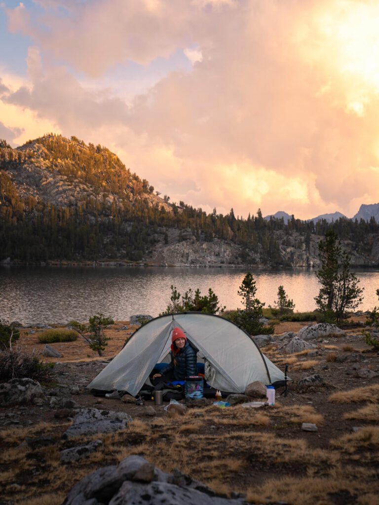
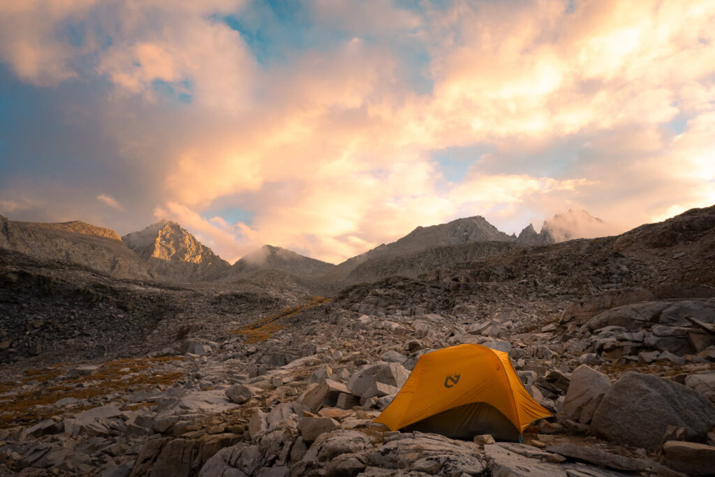
The rest of the day was a blur of steady hiking and quiet conversation. Everyone’s focus had shifted toward the finish line. We reached Guitar Lake around 5 p.m., the traditional camp before the final summit push. Even in late season, there were plenty of tents, so we hiked a bit farther up the trail to find a quieter spot and to shave a few hundred feet off our climb the next morning.
As the sun set, temperatures dropped quickly, and frost began to form again. We crawled into our sleeping bags early, knowing the alarm would go off at 3 a.m.
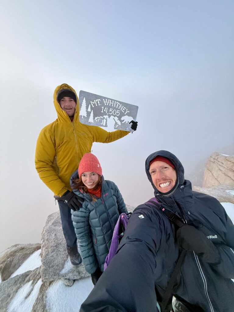
Day 15: Guitar Lake to Mount Whitney Summit and Whitney Portal (JMT Mile 202.3–211)
When the alarm went off in the dark, I could already hear other hikers passing by, headlamps flickering like distant stars. We packed up in the red glow of our lights and started climbing by 3:30 a.m. The air was freezing, but I had learned my lesson from the morning before — too many layers only meant sweating halfway up the switchbacks.
We hiked in near silence, surrounded by blackness and starlight. The beam from Quin’s headlamp was the only thing illuminating the path after mine died somewhere along the way. At the junction to Whitney Portal, we dropped our heavy packs, taking only the essentials for the two-mile push to the summit.
Not long after, we ran into two hikers coming down — women we had met days earlier on the trail. They told us they had turned around before the summit because of icy conditions. For the first time all trip, I wondered if we might not make it. We had already walked more than two hundred miles, and the thought of turning back less than two miles from the finish felt unthinkable. Logically I knew that if we didn’t complete these last two miles no one would consider it a failure. But it wasn’t just any two miles. It was the summit of Whitney. The figurative cherry on top. The literal top of the continental US.
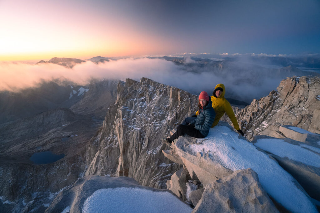
We decided to keep going. The trail was icy in places but manageable, and as the first light touched the eastern horizon, we could see the summit hut ahead. We reached the top of Mount Whitney at 6:15 a.m., just in time for sunrise. The world glowed pink and orange for five perfect minutes before the clouds swallowed everything.
We huddled inside the small stone hut, stepping out now and then to snap a few photos with the Mount Whitney sign before retreating from the biting cold. Despite the whiteout, the feeling of standing there — at 14,505 feet, the highest point in the lower forty-eight after two weeks of determination — was surreal. we were officially done with the JMT. I wondered when it would feel real. Because it sure didn’t in that moment.
From there, it was all downhill, quite literally. The descent to Whitney Portal took us the rest of the day, dropping over 6,000 feet through granite switchbacks and golden light. When we finally reached the trailhead, a little worse for the wear, dusty, and starving, it felt like stepping out of a dream.
Fifteen days, 221 miles, 47,000 feet of elevation gain. The John Muir Trail was everything I hoped it would be — wild, exhausting, humbling, and beautiful beyond words.
Getting Back to Yosemite from the Whitney Portal
When we finally reached Whitney Portal, the finish line did not feel like an ending. It felt like the beginning of another kind of journey.
From Whitney Portal, most hikers catch a ride or hitchhike 13 miles down to Lone Pine. From there, you can take the Eastern Sierra Transit bus north along Highway 395. The route connects to towns like Bishop, Mammoth Lakes, and Lee Vining, where you can transfer to the YARTS (Yosemite Area Regional Transportation System) bus into Yosemite Valley.
Unfortunatly for us, the YARTS shuttle stopped running for the season the day before we finished the hike on September 20th (a familiar story at this point in our trip). In the end, getting back to Quin’s van in Yosemite from Lone Pine took us twenty-four hours and four different hitchhikes. We crossed the entire Sierra Nevada in reverse, still dusty and half-laughing at the absurdity of it all.
My 15-Day John Muir Trail Itinerary
Everyone hikes the John Muir Trail a little differently, but here is a look at how our journey unfolded. We hiked from Yosemite Valley to Mount Whitney over 15 days, averaging about 17 miles per hiking day across 14 hiking days plus one rest day in Mammoth Lakes.
| Day | Route | Approx. Miles | Notes |
|---|---|---|---|
| 1 | Yosemite Valley to random camp in the woods | 10 | Started up the Mist Trail past Vernal and Nevada Falls. Camped off-trail near water before High Sierra Camp. |
| 2 | Yosemite to Lyell Canyon | 18 | Passed Cathedral Lakes and Tuolumne Meadows. Cheeseburgers at the Tuolumne store were a highlight. |
| 3 | Lyell Canyon to Thousand Island Lake | 15 | Crossed Donohue Pass and entered the Ansel Adams Wilderness. Reached camp just before a rainstorm. |
| 4 | Thousand Island Lake to Red’s Meadow | 17 | Rained all day. Everything soaked. Would love to come back to explore more of this area. |
| 5 | Zero day in Mammoth Lakes | 0 | Dried gear, resupplied, and ate everything in sight. |
| 6 | Red’s Meadow to Lake Virginia | 16 | Thunderstorms, a swim in Purple Lake, and the best sunset yet. |
| 7 | Lake Virginia to Vermilion Valley Resort (via Goodale Pass) | 18 | Long detour to pick up resupply boxes. Slept in an empty canvas tent at VVR. During peak season ferry boat across Lake Edison makes this an easier resupply. |
| 8 | VVR to Marie Lake | 16 | Fell and broke my arm without realizing it. Gorgeous views and a beautiful camp at Marie Lake. |
| 9 | Marie Lake to McClure Meadow | 19 | Entered Kings Canyon National Park. One of the most peaceful camps of the trip. |
| 10 | McClure Meadow to Middle Fork Kings River | 18 | Crossed Muir Pass and stopped in the stone Muir Hut as a storm rolled in. |
| 11 | Middle Fork Kings River to Kings River Camp | 19 | Over Mather Pass and through the Golden Staircase. One of the most picturesque day of the trip. |
| 12 | Kings River Camp to Dollar Lake | 16 | Hail on Pinchot Pass but ended with a calm night overlooking Dollar Lake. |
| 13 | Dollar Lake to Camp Below Forester Pass | 17 | Spent the morning at Rae Lakes before hiking to our highest camp yet. If I could do over would build in an extra day at Rae Lakes. |
| 14 | Forester Pass to Camp Above Guitar Lake | 19 | Clear skies and big climbs. Camped beneath Mount Whitney. |
| 15 | Guitar Lake to Mount Whitney Summit, then down to Whitney Portal | 15 | Reached the summit at sunrise and descended to the finish line. |
This itinerary was ambitious for us, especially because in September daylight is shorter and temperatures drop fast. If I were to hike the JMT again, I would definitely add a few more days to slow down and spend more time in my favorite sections, like Evolution Valley and Rae Lakes.
Tips for Planning Your Own JMT Itinerary
There is no single “right” way to hike the John Muir Trail. Your pace will depend on experience, fitness, weather, and how much time you want to spend soaking in the views. Many hikers take between 18 and 25 days to complete the trail, while others move faster with lighter packs and fewer breaks.
When planning your itinerary, think about how you want the trip to feel rather than just how fast you can finish. Build in rest days around resupply points like Vermilion Valley Resort or Mammoth Lakes, and allow time to linger in places that catch your heart. The JMT is not a trail that rewards rushing.
If you are new to long-distance hiking, aim for 8 to 12 miles per day at the start and let your body adjust. Once you are acclimated to the altitude and rhythm of the trail, you will naturally cover more ground each day.
Above all, remember that the itinerary is just a framework. The real journey happens in the spaces between the miles.
Recommended Resupply Points on the John Muir Trail
Even the most ultralight hiker needs to eat, and food is usually the heaviest thing in your pack. Planning a few resupply stops along the John Muir Trail can make a huge difference in comfort and flexibility.
Most JMT hikers send resupply boxes ahead to small outposts or resorts along the route. These stops not only lighten your load but also give you a chance to shower, do laundry, and reconnect with a bit of civilization before heading back into the mountains.
If you are hiking southbound (SOBO), like we did, most of the convenient resupply options are located during the first half of the trail. With a little planning, you never have to carry more than a few days of food at a time until after Muir Trail Ranch (MTR). After that point, options become far more limited.
Here are a few of the most common and reliable resupply locations:
| Location | Approx. JMT Mile | Details |
|---|---|---|
| Tuolumne Meadows Post Office | 24 | Convenient early stop inside Yosemite National Park. Great for a quick snack or light resupply. Note that the post office and store close by early fall. |
| Red’s Meadow Resort | 57 | Near Mammoth Lakes. Offers a small store, restaurant, and showers during the open season. Late-season hikers can take the shuttle into Mammoth for food and rest. But check the schedule in advance. When we were hiking the shuttle only ran on weekends. |
| Vermilion Valley Resort (VVR) | 88 | A classic JMT stop. Normally accessed by ferry across Lake Edison, though hikers can walk in via the Bear Ridge or Goodale Pass Trail when the ferry stops for the season. Offers camping, hot meals, laundry, and mail resupply boxes. |
| Muir Trail Ranch (MTR) | 107 | The last major resupply before Mount Whitney. Offers buckets of your mailed food and limited store options. No lodging or restaurant, but hot springs nearby make it a popular stop. |
| Independence/Bishop (via Onion Valley or Bishop Pass) | 170 | Optional off-trail resupply via Kearsarge Pass. Adds a lot of extra mileage but allows a full town stop and mail pickup if needed. |
When we hiked the JMT during the second half of September, every one of these resupply points except VVR was closed for the season. Even VVR was technically closed. We were only able to pick up the food we had shipped ahead of time because the caretaker kindly helped us access our boxes. The store and restaurant were shut down, and the place felt like a ghost town.
Since we did not want to hike all the way out over Onion Valley for another resupply, VVR ended up being our one and only. It made for a heavy pack through the southern half of the trail, but it was still completely doable with some careful planning.
In an ideal world, where everything was open, I would plan on a meal and small shopping spree at Tuolumne Meadow, a resupply at Red’s Meadow, and another at Muir Trail Ranch. I would only send a resupply box to MTR to make sure I had enough food I liked to get me through the second half of the trip. Of course this is really only an option if you are planning on covering the distance between MTR and Whitney Portal in a week or less. If you’re taking your time, then you’ll realistically need to plan an additional resupply in Independence/Bishop.
If you are hiking later in the season, check opening and closing dates for every resupply stop well in advance. A little preparation here can save you a lot of weight — and a lot of hungry miles.
My MVP Gear List for the John Muir Trail
After fifteen days and 211 miles on the John Muir Trail, a few pieces of gear truly earned their place in my pack. These are the items that held up through storms, endless climbs, and more than a few miles of granite switchbacks. They are the ones I would bring again in a heartbeat.
This is not a full packing list, just my MVPs, the gear that made the biggest difference on the trail. If you want to see every single item I carried, including weights you can check out my full John Muir Trail Gear List blog post, or you can check out my Ultralight Gear Guide for my detailed descriptions of my favorite backpacking gear.
Shelter and Sleep Gear
SLEEPING BAG – The Feathered Friends Egret UL 20 has been my go-to sleeping bag for the last two seasons because it’s lightweight, insanely warm for its weight, and compresses small enough to save space in my pack. Plus, I love that Feathered Friends is a local Seattle company internationally respected for its down gear.
SLEEPING PAD – As a side sleeper, I’m picky about sleeping pads, and the NEMO Tensor Trail Ultralight Insulated Sleeping Pad is one of the only ultralight pads I’ve found that’s genuinely comfortable (for a sleeping pad). It’s warm, lightweight, and packs down small, but still has enough cushion to sleep well after a long day on the trail. After years of use, it’s proven reliable and worth every ounce.
BACKPACKING PILLOW – The Sea to Summit Aeros Premium Pillow is the best ultralight pillow I’ve found. Does is feel like your pillow on your bed at home? NO. But, it’s still one of those little luxuries I never regret packing. It’s ultralight, packs down to nothing (we’re talking the size of a small fist), and inflates in seconds — but still feels soft and supportive enough to actually sleep decent in the backcountry.
Food, Water, & Kitchen Gear
NALGENE – It may seem old school, but a Nalgene is one of the most versatile pieces of gear I carry. It’s indestructible, easy to clean, and works for everything from water storage to mixing drinks or rehydrating meals. On cold nights, I’ll even fill it with boiling water, seal it tight, and tuck it into my sleeping bag for extra warmth.
PEAK REFUEL BACKPACKING MEALS – Peak Refuel meals are my go-to for backpacking because they’re high in protein, and actually feel like real food at the end of a long day. My favorites are Butternut Dal Bhat (great for my vegi friends), Chicken Coconut Curry, Homestyle Chicken and Rice (with hot sauce), and last but not least Sweet Pork & Rice (if I’m not traveling ultralight, I like to wrap this one up in a tortilla and add avocado).
Other Backpacking Gear
GPS COMMUNICATION – I carry the Garmin InReach Messenger Plus for peace of mind on backcountry trips — it lets me send texts and share my location even when there’s no service. The battery lasts for days, and it’s a small, reliable way to stay connected and safe when I’m off the grid. AND you can send photos and voice notes which came in pretty handy after I injured my wrist!
Watch the video I made about the Garmin Messenger Plus! It’s one of my favorites.
*** Garmin also recently launched the inReach Mini 3 with photo and voice messaging capabilities. So you have two really good options!
TREKKING POLES – Durston Iceline Trekking Poles. If I had to pick one MVP item from the entire JMT these trekking poles would easily get the reward. I haven’t traditionally hiked with polls because I’ve never had a pair that I really liked, but I’m officially a convert. I chose these because they’re incredibly light (under 10 oz per pair) and designed for strength, and they definitely delivered.
WATCH – A GPS watch might not exactly be an essential. But I loved being able to track my distance and time each day on my Garmin Fenix 8. Plus, it let me know how I was sleeping, and if I needed to take it a little easier on a specific day.
Clothing Essentials
SUN SHIRT – The Crater Lake Hoody is my favorite sun shirt because it’s so light and soft it almost feels like air. It offers full UPF 50+ protection for long days in exposed terrain, so I don’t have to carry buckets of sunscreen.
INSULATED LAYER – Rab’s Mythic G Down Jacket. Light and ultra-warm, this is my new favorite for backcountry travel.
Shoes
TRAIL RUNNERS – I picked up a brand new pair of Hoka Challenger Trail Running Shoes before leaving for the JMT. I prefer trail runners over hiking boots for long distance backpacking trips because they’re lighter, more breathable, and dry quickly. This newest iteration of the Challenger was even better than my last pair! In fact, this is the first time I can remember that I haven’t had sore feet after putting in serious miles.
| Just a quick heads up! Some of the links on this blog may be affiliate links, which means that if you click on them and make a purchase, I may earn a tiny commission. Don’t worry, though – it won’t cost you anything extra, and it’s a way for me to keep this blog up and running. Thanks for your support! |
Things I’d Do Differently (and What I Wish I’d Known Before Hiking the JMT)
Looking back, there are a few things I would change — not because the trail went wrong, but because hindsight is always clearer once the dust settles.
Start Earlier In The Season: Hiking in late September meant we had the trail almost all to ourselves most days, but it also meant colder nights, unpredictable storms, and several closed resupply points. If I were to do it again, I would start in mid to late August to catch a little more daylight and keep my options open, while still avoiding peak mosquito season.
Give Myself More Time: We averaged about 17 miles per day, which felt ambitious with heavy packs, rough weather, and shorter days. If I could redo it, I would stretch the hike over a few more days to slow down, take more photos, and spend extra time in favorite spots like Evolution Valley and Rae Lakes.
Double-Check Late Season Logistics: I wish I had realized just how many of the usual resupply points shut down by mid-September. Having only one true resupply at Vermilion Valley Resort worked, but it made for some very heavy food carries. If you’re hiking late in the season, confirm what’s open before you go.
Pack Less Clothing: Even though I thought I was packing light, I still brought more than I needed. One pair of shorts, one pair of pants, and something to sleep in would have been enough. Once you’re out there, you quickly realize how little you actually need.
Food Organization: I would organize my food by day, so that I knew exactly how much I could (and should) eat each day. This sounds obvious, but if you aren’t paying attention it’s super easy to snack your way through your food much faster than you can afford too. Especially right after a big resupply when food seems limitless.

Final Thoughts on the John Muir Trail
People always say the John Muir Trail is one of the most beautiful hikes in America, and they are right. But beauty only tells part of the story.
The JMT is hard. It is long and steep and unpredictable. It is soaked gear, tired feet, and the slow realization that comfort is something you leave behind. Somewhere along the way though, the rhythm of the trail begins to make sense. The trail strips away everything unnecessary until you’re left with something simple and pure. The endless walking, the setting up and tearing down of camp, the quiet in between. Eat. Walk. Sleep. Wake up and do it again.
When I finally made it home, I went straight to urgent care. The doctor took one look at my swollen wrist and ordered X-rays. Turns out, it was broken in two places. Somehow, I had hiked more than a hundred miles like that.
Now, when I think about the John Muir Trail, it’s less about the challenge or even the scenery. It is about the way it slows you down, reshapes your sense of time, and quietly asks who you are when things get uncomfortable. The JMT reminded me that resilience is built one mile at a time.
Now, looking back, I realize that was the whole point. The John Muir Trail isn’t about conquering anything. It’s about learning how to keep showing up — even when you are cold, tired, and not entirely sure why you started in the first place.
If you are planning your own John Muir Trail adventure, I would love to hear about it. Every experience on this trail is different, and that is what makes it so special. Feel free to share your questions, stories, or plans in the comments below — I am always happy to help or simply cheer you on from afar.
More Blog Posts For You
Everything I Packed For The John Muir Trail
Complete Backpacking Checklist
Your Guide To The Best Camping Spots In Yosemite
Hiking The W-Trek In Patagonia
Like this post? Pin it for later and share it with others!


Hi Jess!
Loved reading the blog post!
What an awesome adventure, I‘m in awe!
Did any of you have to deal with blisters on your feet? How did you manage them or if not how did you prevent them!
Blisters is something that has ended many of my attempted „long distance „ treks 🙁
Thanks so much! Luckily none of us dealt with any serious blister issues. Because blisters are caused in large part by friction, I have found that the best way to prevent blisters is by finding the right socks, minimizing heat and moister, and keeping your feet as clean as possible. We all wore well fitting wool socks, which help with the heat and moisture element. But we also stopped along the trail quite a bit to take our shoes and socks off and soak our feet in cold water. Which I think also really helped keep our feet clean and manage over heating. Best of luck out there!